Virtual Collections Map
The Virtual Garden Map is accessible on cell phones, tablets and computers, and allows you to search for plants or virtual collections. The map provides a way in which students, instructors, researchers, and the public can graphically investigate the plants of the Beal Botanical Garden. Beyond the geographical location of each plant, the map contains information such as the scientific name, common name, plant family, date planted, and any significant collection status, such as Michigan Native Plants, plants used by the Anishinaabe, or collections specific to classes or projects. Capabilities of the map include:
-
Searching or filtering for and locating trees by family, genus, species, scientific name, common name, and accession number
-
Filtering to specific groups of plants, such as those used in a course
-
Browsing by panning, zooming, and using the My Location button to move the map to your location
Instructors and researchers can work with Beal Botanical Garden to record which plants they use for courses and research which allows users to filter the map to the appropriate plants.
Instructions for use:
Generally, you will have better search results if you use the filter just below the search box. To use the filter, click on the filter icon, select an item from the drop-down menu, choose an item (collection) from the list, and either select "Apply" to return everything in that collection or further restrict your results by searching for a term within the collection. RESET the filter between every search or your results will be incomplete.
-
“Family” will filter for the scientific name of the family (as in Fagaceae for the Oak family). It will not filter for common names of families.
-
“Name” filters for a scientific name (genus plus specific epithet).
-
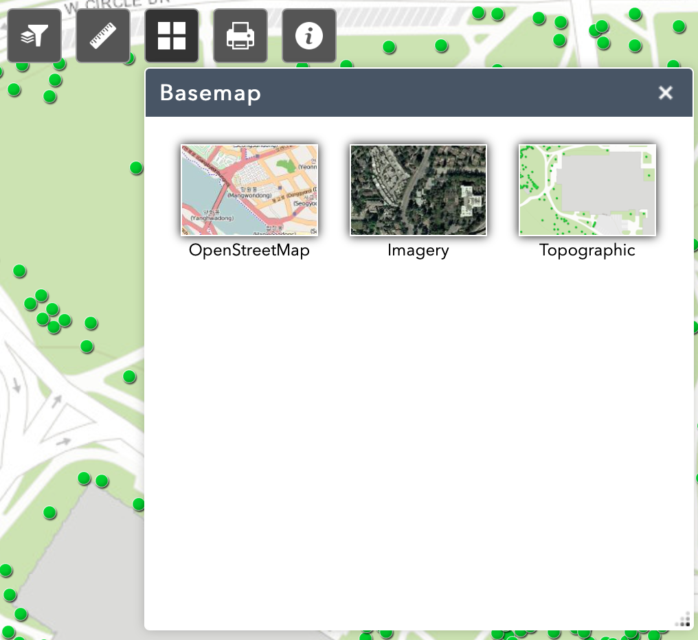
Other filters allow you to search for our virtual collections. These are accompanied by brief text in the popup menu you can access by selecting a specific plant (dot) on the map. You can change the base map from an ARCGIS campus map to a satellite image or open street map using the tile button below the search box.
While this tool is an excellent way to discover what plants may be close to you or around a particular building, or to identify locations for a species of interest, if you need up to date, complete data please contact our staff for a custom search.
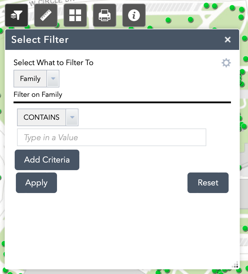
The filter icon appears below the search bar, to the far left. Between searches, click the Reset button.
To change the basemap, select the tile icon located in the center of the icon list.